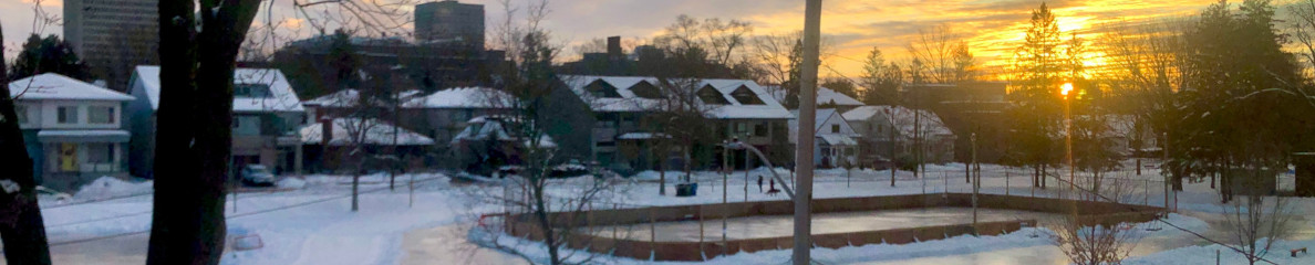
The draft version of the first three chapters of this plan plus seven appendices is now available online on the NCC’s (National Capital Commission) web site. Public consultation is planned for early October so watch for NCC ads. The urban lands covered in this plan include green and blue areas (valued ecosystems areas e.g. Mud Lake); Capital parks (e,g, Major’s Hill Park) and shorelines (along the Ottawa, Gatineau and Rideau Rivers and the Rideau Canal plus a few creek areas); Parkway and Pathway networks (e. g. SJAM (Sir John A. McDonald) Parkway); Employment sectors and other Federal facilities (e.g. Tunney’s Pasture); Cultural and Historical Institutions sites and facilities (e.g. Central Experimental Farm) and other NCC lands without an established use related to capital functions. Note that non NCC lands (mostly other federal lands) may be included except in this last category. I have given a few highlights of the plan with more details re Parkways in general. Finally from an Appendix “Summary of Ottawa River Shoreline Initiative” more specific possible plans for SJAM Parkway which may form part of a later sector plan are noted.
The draft vision states: “An aesthetic, viable and dynamic enhancement of the Capital Urban Lands, combining nature and culture, today and tomorrow.” A reference to heritage might be included perhaps by changing the last clause to “yesterday, today and tomorrow”
The Plan will include sub-plans called sector plans – one for the Western area, one for the Rideau Canal area and one for the Eastern area and the already completed Core Area Plan. Also a “Parkway Policy Review” will guide plans for the parkways. The three roles of the urban lands suggested by the draft plan are: “Contact with Natural, Green and Blue spaces”: “Provide pleasant, welcoming and animated places that offer a rich and varied expression and experience”; “Contribute to regional viability through the federal presence and its interaction with the overall context and encourage sustainable and active mobility”. The goals of each role are also of interest.
For the contact with nature role the two goals are: “Protect, restore and maintain valued ecosystems and habitats and reinforce them in view of sustaining biodiversity in the Capital Region” and “Promote contact with green and blue spaces, the natural environment and valued ecosystems for the benefit of all as a priceless resource and a vital space for the future of an increasingly urbanized region”. In connection with these goals shorelines are noted as important and guidelines include “Renaturalize shorelines and wetlands”; “Develop conservation plans and waterfowl and invasive alien species management plans” and “Reduce pollution levels in watercourses”. As well improved access to shorelines is suggested along with more visitor services. In particular for the Parkways Network it is expected that the Policy review will “maintain and enhance their contribution to the green spaces system and encourage contact with nature”
For the pleasant, welcoming and animated places role the goals are: “Embellishment-Promote design excellence and embellishment as a foundation for Capital expression and experience“; “Sense of Place – Protect and enhance the quality of various settings, links, views. Heritage sites natural and cultural landscapes”; and “Welcome – Propose sites and routes in the Capital that enrich, enliven and animate urban living, complement the Capital Core Area and offer the possibility to host a range of activities (from quiet contemplation to festive vibrancy” Among the guidelines for the first goal are: “Develop a view protection policy for valued cultural landscapes…” and “Identify and preserve the visual perspectives to and from both sides of the Ottawa River and integrate the accompanying green spaces as key components of these visual improvements”
In the case of the second goal (Sense of Place) there is an additional specific Parkway network goal as follows: “Maintain, protect and enhance the Capital’s distinctive, beautiful, verdant and picturesque parkway network.” and the following guideline “Provide landscape treatment for subject sites that is consistent with the local parkway character and maintain a landscape framework consistant with the parkway environment (partial vegetation filter or solid screen effect)”
Finally the third goal (Welcome) for this role (Expression and Experience) mentions Discovery Routes which may focus on museums and perhaps other attractions using where appropriate the Parkway network. As well one orientation suggests developing sites according to their potential in keeping with their capacity, character and vocation (Spirit of Place). Notable also is the orientation “Reinforce the role of parkways as ‘places’ and destinations as opposed to throughways.” Guidelines of which the following seem important for the parkway network: “As a priority, consolidate sites that are already developed and accessible by various means of transportation”; “Offer activities which are compatible with the surrounding neighbourhood”; “provide basic services to ‘Capital Discovery Route’ users” and finally “Support the creation of leisure areas, recreation areas, gathering places and picnic areas along the parkways, and provide access to these sites.”
The third role of “Viability and urban integration”’s first goal is given as “Contribute to regional viability through the development and consolidation of federal lands and Capital functions and encourage their integration into the broader urban context.” While the NCC seems to have conceded the planning of campuses such as Tunney’s Pasture to the Department of Public Works it still has approval authority of such plans. For that reason the three orientations re this goal are of interest and speak to distributing such federal facilities throughout the region; improving their interaction with surrounding land uses and promoting environmentally sustainable development. Note as well that one of the guidelines talks about “develop the edges of existing and planned employment campuses to improve the interface with their surroundings…” As well priority is to be given to existing serviced sites in the urban area and for those on or planned along public transit system routes intensification and mixed-use urban development is to be encouraged. For actual NCC lands the orientation is to: “Specify the prescribed uses and management direction for various NCC lands” and the guidelines are “to evaluate the highest and best land uses and management practises that supports the NCC mandate….” and “review existing land uses based on applicable municipal and federal land use plans” In other words what is the market for them if they do not fit the roles identified by this draft plan.
The other goal for this role is “Plan the distribution of federal activities, employment areas and facilities as well as recreation spaces to improve accessibility and promote sustainable and active mobility.” The orientations and guidelines speak of connections and links to enable easy links between modes such as between pathways and transit.
The specific orientation for the Parkway network is “consider the parkways first and foremost as a linear network with a primarily recreational vocation and providing access to Capital sites not as extensions of the municipal and regional road networks”
While this was being written Chapter 4 was posted to the web site. This details what the land uses will be for most of these lands. As one might expect there are some lands designated as special study areas (e.g. Rockcliffe Airbase lands and area near Bayview), some with no designation (not part of the Realm Land) (e.g. portions of the Southern Corridor). However as far as I can gather from the maps all parts of the SJAM Parkway from Britannia to Bayview are either designated as Valued natural Habitat or Capital Urban Greenspace (including I believe Rochester Field although the map detail is hard to read). It seems likely that very few green areas other than the Southern Corridor will be at risk, which is good news, although the loss of the latter is not welcome.
Now for the more interesting part of the Master plan report found in Appendix 6 “Summary of Ottawa River Shorelines Initiative”. The goal of this study was to suggest projects or actions that respect the natural environment and site capacity of the shorelines involved but also improve accessibility and activity along the riverfront. While the study included the Core Area, Voyageurs Corridor, Lac Leamy and the Rockcliffe Parkway I will confine my report to the SJAM Parkway. The following sites were selected: Mud Lake area; parking area near Woodroffe; Westboro beach area; Bate Island, Champlain Bridge area and Remic Rapids area. I will cover the last four.
For Westboro Beach a more official launch area for non-motorized small craft at west end of beach is suggested. Also support of water activities such as regattas, kayak/canoe lessons cross-river excursions to Voyageurs Corridor. Explore potential for a more permanent restaurant and building which might house more washrooms, rentals of boats etc. and possibly a trailhead. Encourage winter recreation: cross-country skiing, snow-shoeing and community events and activities.
At Bate Island increased levels of activity are suggested including seasonal presence of educational/environmental programs and activities such as River stewardship; potential for mobile seasonal food concession (portable toilets, bike racks, waste receptacles, seating, picnic tables if not already there) and if needed improved path or road access; also interpretation, public art, community based performing arts, recreational rental. Given the use of the areas by kayakers the suggestion of community and interest group partneships seems a good idea.
At the Champlain bridge parking area the suggestions include: RivBox3 in the parking lot or Building 3 set back from the river. RivBox3 includes seating, picnic tables, portable toilets, waste receptacles, bike racks, improved path or road access (RivBox1) plus interpretation, public art, floral vision element (RivBox2) plus programs, events and commercial elements (to scale) such as mobile food concession, recreational rental, community based performing arts (RivBox3). Building 3 is a permanent structure on a foundation with full services (all season, bathrooms). As well this area should have the existing parking lot and ramp rationalized, encourage fishing from shore, act a tour bus stop, and perhaps be used for commemorations (my suggestion – loggers with pole with log jam; voyageurs). To improve Pathway under the bridge add lighting, possibly public art. Efforts should include highlighting views.
Finally at Remic Rapids there is again a suggestion to expand the range of events and activities with thematic focus, including guides, enactments, information, provincial programs, fishing activities. (Perhaps the use of the river water to cool the air for buildings in Tunney’s Pasture is behind some of these suggestions) The location with an existing parking lot and proximity to Tunney’s Pasture & Transit makes this location more attractive. Again we have a suggestion of RivBox3 or Building3 (possible restaurant or interpretation centre). Bathrooms need improvement; potential commemoration site; public art and performances support creation of destination (existing river artist has already done this to a fair extent). Thus another tour bus stop. Winter recreation might be encouraged by rental of snoeshoes, volunteers setting cross-country trails.
You will notice that in all this there is no mention of Carleton Avenue and its access to the river. Perhaps some of you might like to suggest some improvements there (more seating?) and activities which our community could foster there. Or perhaps we could participate in activities at either the Champlain or Remic Rapids sites. If you have any ideas please plan to participate in the sector plans where these ideas will be discussed further.